The city of Chennai has suffered from flood-related woes for the last few weeks and today was no better as heavy rains returned to the metropolis.
And Chennai residents are now attempting to be better prepared. A crowd-sourced effort has helped to build a digital map that identifies flooded streets in the city. At present the map shows 1515 inundated roads.
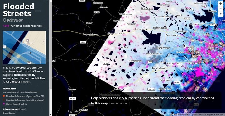
The map is open to all and anyone can access its data by clicking on the left side on a specific link. Presently the map displays information about affected areas and flood relief camps, both open and closed ones.
This has been a good digital initiative to map the continuous floods and the measures taken to control them. Citizens can report a flooded street, affected area and come to know about the relief measures in different parts of the city simply with a click on their smartphone.