India has been going through a spate of border disputes in recent times, from the Chinese ‘incursion’ to a face-off with Nepal. Now, there’s more news of trouble in terms of what constitutes India and what doesn’t.
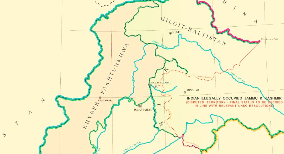
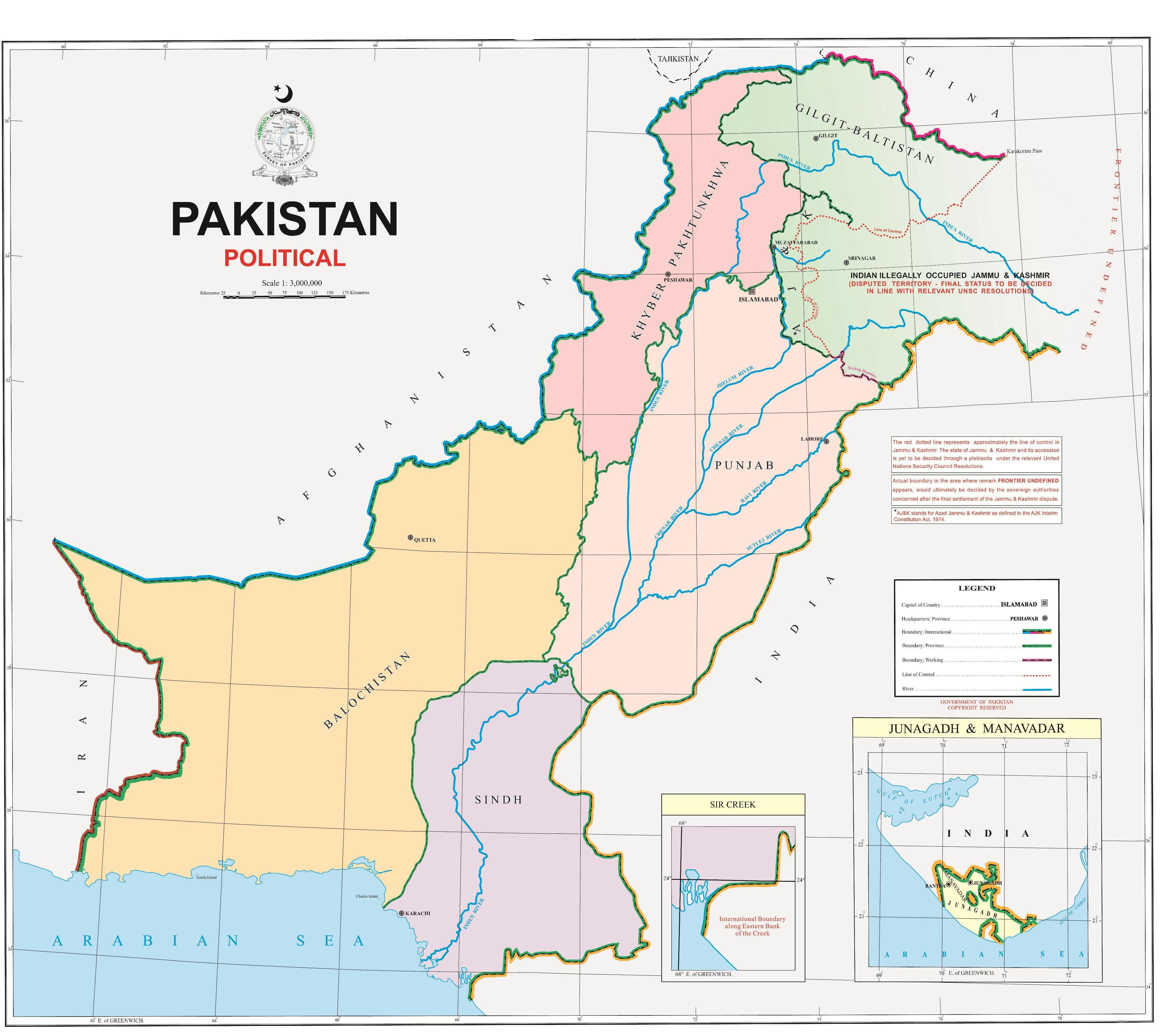
The Pakistan government unveiled a ‘new political map’ that shows a part of Jammu and Kashmir and Ladakh with the lines, ‘Indian illegally occupied Jammu and Kashmir’.
Under that, there’s more text that reads, ‘Disputed Territory – Final Status will be decided in line with the relevant UNSC resolutions’. According to The Wire, Junagadh, a city in Gujarat, is also shown as part of Pakistan.
While India called the move an ‘exercise in political absurdity’, Pakistani foreign minister S.M. Qureshi stated that the map ‘reflected the aspirations of the people’.
Qureshi also said that the map included the Siachen glacier, adding,
Through the map] we are challenging their illegal occupation and claiming our right to the area.
Prime Minister @ImranKhanPTI unveiled the political map of Pakistan at an event earlier today. pic.twitter.com/6Iqj9YzX4K
— Prime Minister’s Office, Pakistan (@PakPMO) August 4, 2020
Meanwhile, India’s Ministry of External Affairs has termed these claims ‘ridiculous and untenable’ with no legal validity or international credibility.
However, there does not seem to be any actual change in the territorial outlines of the map, compared to the previous official version. So the only actual difference is the text that has been added, referring the UNSC resolutions.
The Indian government has also confirmed that there are no territorial differences, and the whole thing is apparently more of a PR exercise.