


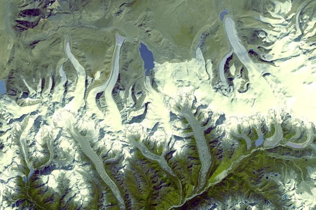
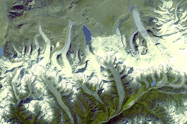
During the 1970s-80s, a US spy programme, called Hexagon launched 20 satellites into the orbit to secretly photograph the Earth. Among the photos taken, are the Himalayas, a region for which historical data is scarce.
A Columbia University research team has studied satellite images obtained from old spy satellites proving climate change is real, and it is has been happening for the last 50 years.

These images have revealed the drastic extent of ice loss in the glaciers of the Himalayas. Comparing photos from this mission to recent satellite images, scientists have found that since 2000, glaciers heights have been shrinking by an average of 0.5m per year.
Researchers claim that climate change is the main cause. This research has been published in the journal Science Advances

The research team from Columbia University has studied data and photographs on 650 glaciers spanning 2,000 kms across the Himalayas.
It was observed that between 1975 to 2000, the region was losing an average of 4bn tonnes of ice each year.
Comparatively, between 2000 and 2016, the glaciers were melting approximately twice as fast – 8bn tonnes of ice each year.
For scale, 8bn tonnes of ice is enough to fill 3.2 billion Olympic-sized swimming pools each year.
Changes in rainfall in the region and soot deposited from the industrial pollution have thought to quicken the melt. Although these were also contributing factors, the research team says that the main cause was rising temperatures in the Himalayan region.


