As the heat-wave grips India amid the ongoing pandemic, an interesting portal run by NASA shows just how bad it is with satellite images indicating the land temperature in the country.
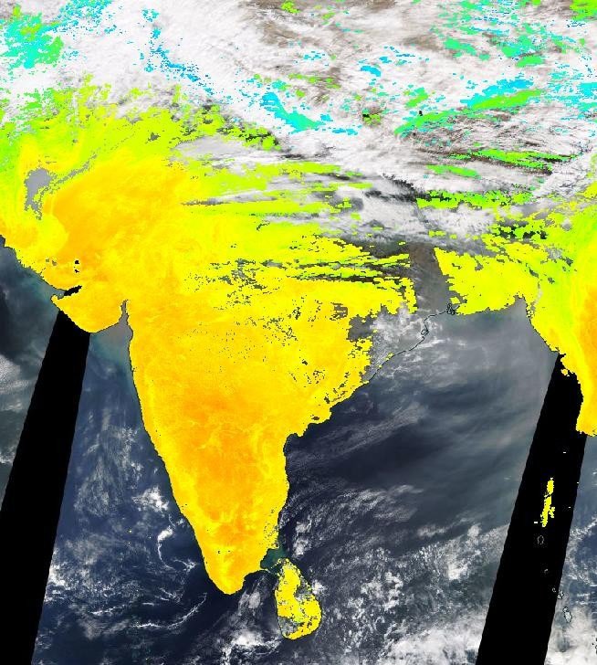
But for perspective, you must look at the image of India from January 21. As you can see, most of the country looks yellowish-green, which means that the temperature was relatively lower.
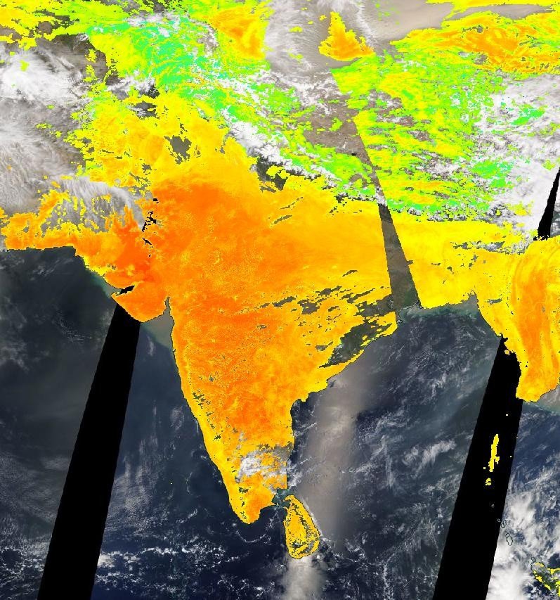
Now, in sharp contrast, here is a picture from May 26. The surface of the country looks like it’s burning; because truly, it is.
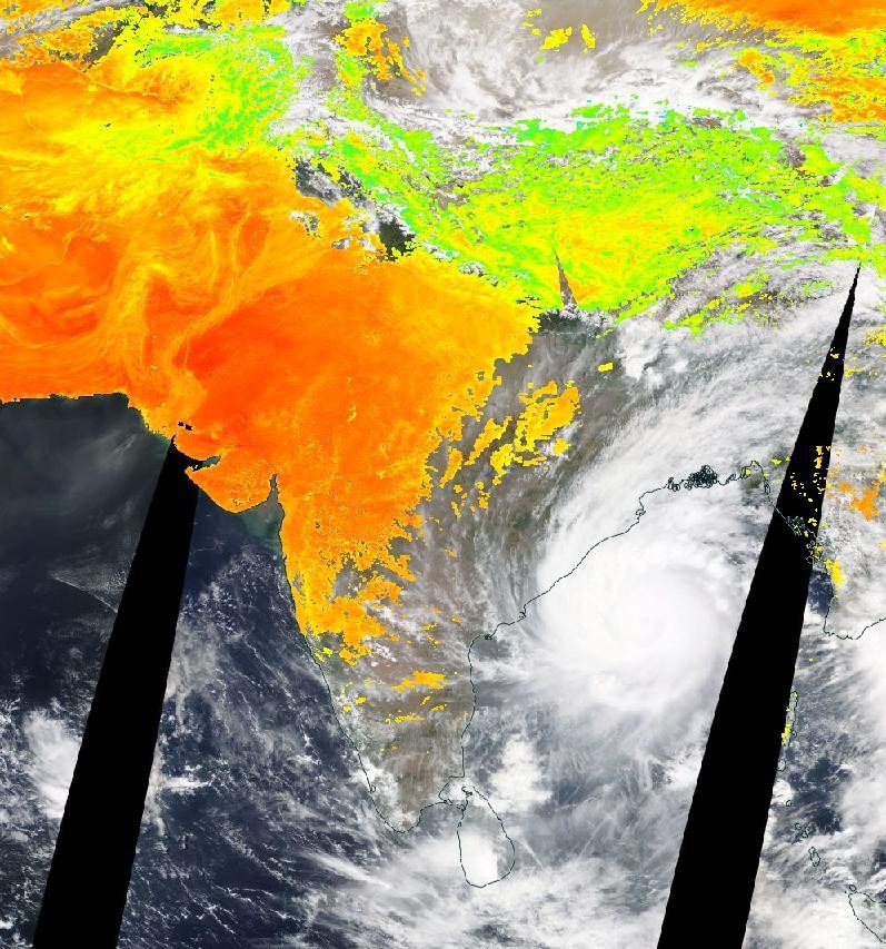
Here is another from May 19, in which you can spot cyclone Amphan which was about to cause devastation in West Bengal.
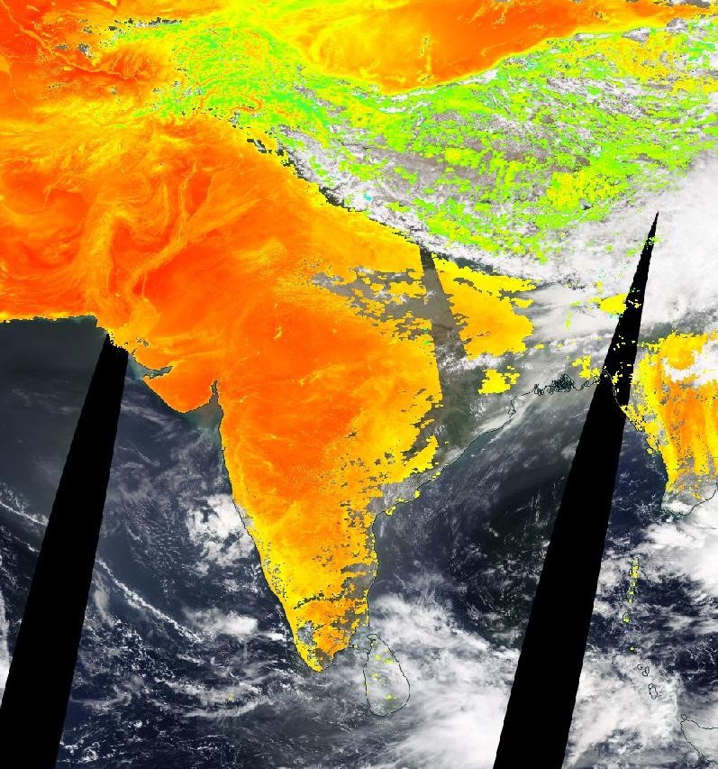
The temperatures seem to have risen all of a sudden because things didn’t look so bad in April. Here is an image from the 10th of the month.
The NASA portal says that this feature gives the temperature of ‘whatever is on the surface of the Earth. For example, bare sand in the desert, ice and snow covered area, a leaf covered tree canopy and even the temperature of man-made buildings and roads’.
And looking at the pictures, it’s clear how intense the heat wave really is.
Which doesn’t come as a surprise after Rajasthan’s Churu recording 50 degree Celsius yesterday (May 26), which was the highest in the world. Meanwhile Delhi also witnessed the hottest May day in at least a decade.