Invading a country is a serious thing. Normally, there has to be an agenda behind it. You can’t just go roaming across the border. Especially not with troops. Well, here’s an intriguing story that unfolded sometime in November 2010 involving the Nicaraguan Army and it turned into a comedy of errors.
You know what maps are meant for, right? They have these squiggly lines that denote borders, so that you know which side is yours and till where you can tread. This tale is about when Nicaragua literally ‘overstepped the line’ and invaded Costa Rica by mistake.
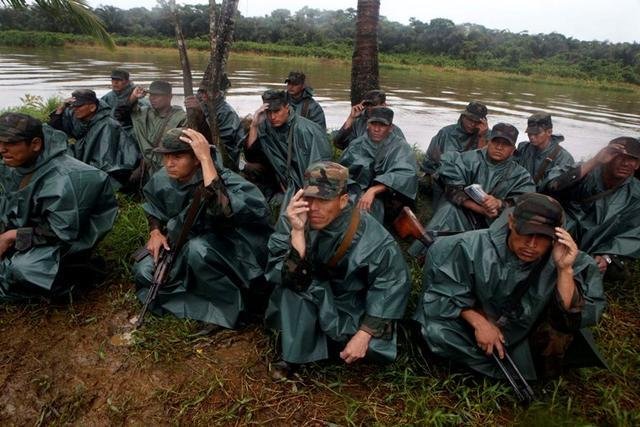
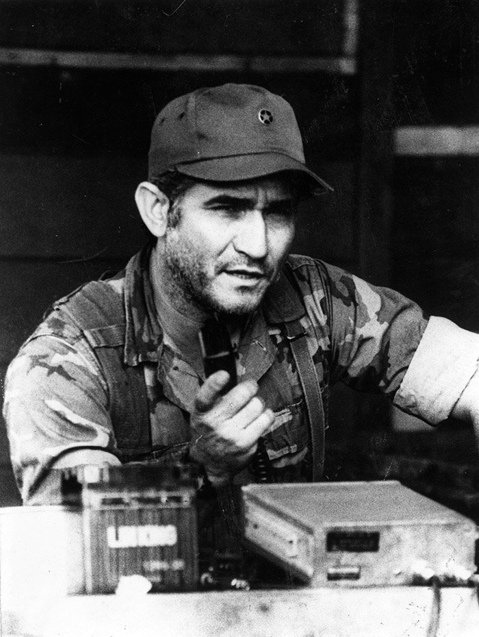
Led by Eden Pastora, an ex-guerrilla commander, the Nicaraguan troops crossed the San Juan River to enter Calero Island, which is part of Costa Rica, and planted their flag there. Interestingly, Pastora had fought against the Nicaraguan regime as a guerrilla. There’s a long history there. But this about something else.
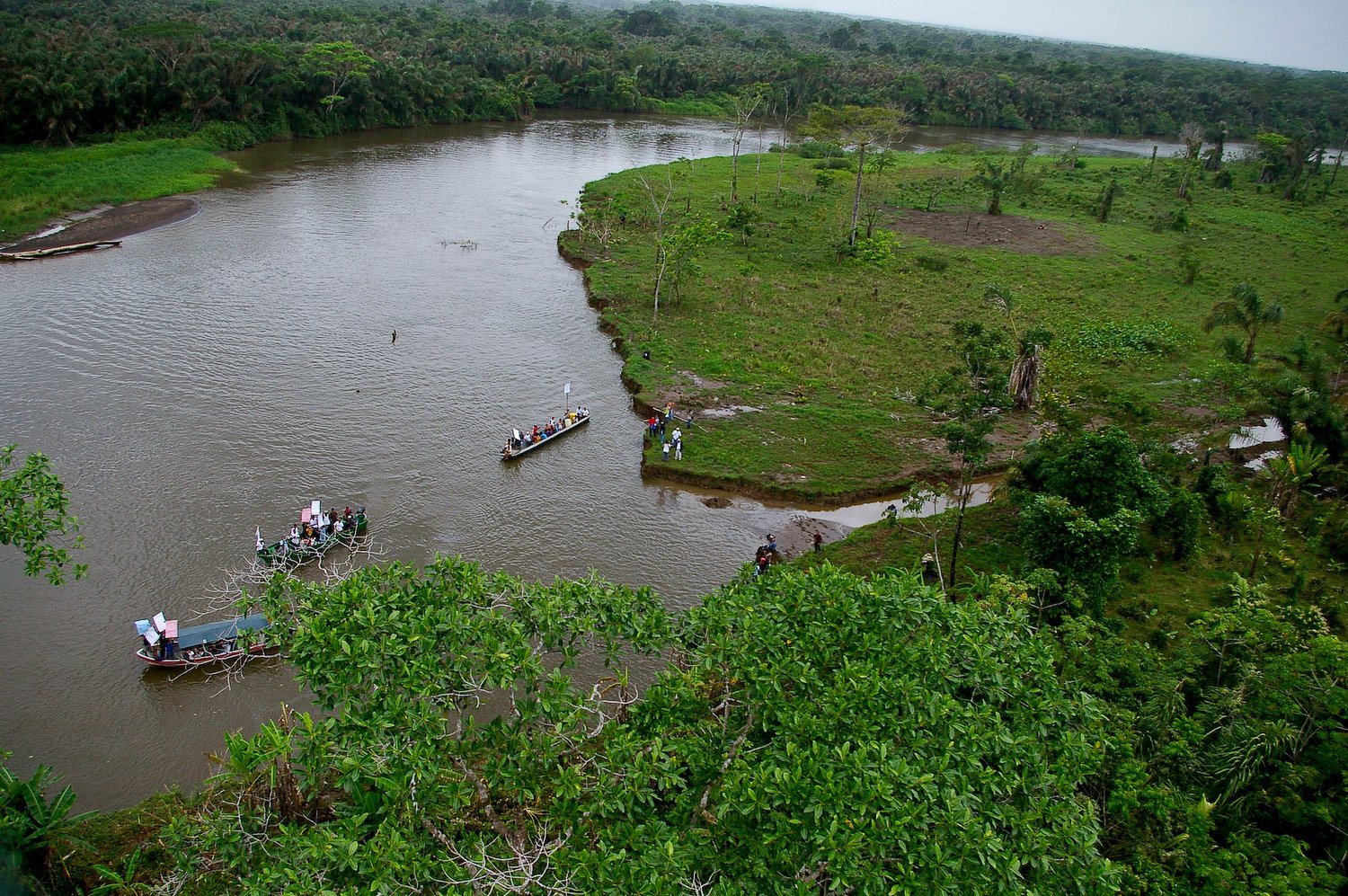
The troops were apparently there to dredge the river. For those who don’t know, dredging is basically scooping out waste from the riverbed. Which they have every right to do, since the San Juan River belongs to Nicaragua.
The issue was crossing to other side and planting a flag on foreign soil and setting camp there.
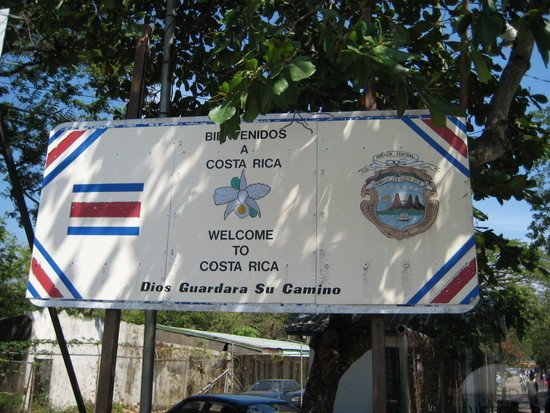
Obviously Costa Rica had an issue with it. But they don’t have an army. So they sent the police force to deal with the issue, while their President took it up with Organisation of American States (OAS) – a body that was founded for the purpose of maintaining sovereignty between member states.
In his words, “Costa Rica is seeing its dignity smeared.”
In their defence, Nicaragua said that according to Google maps, the territory was inside their borders. Pastora told a Costa Rican newspaper, “See the satellite photo on Google and there you see the border.”
After an inquiry, Google admitted to the mistake saying that it had handed a 1.7-mile Costa Rican territory to Nicaragua.
But they also blamed the data provided by the US and also claimed that borders often change.
On the other hand, the Nicaraguan foreign minister said that the maps were accurate because the river belonged to them and the island is made up of silt from the river. They also alleged that the since the river is drying up on the Costa Rican side, they keep advancing to claim land that isn’t theirs.
A warrant was also issued against Pastora for environmental damage to Costa Rican land. But then he changed his Google map statement to, “The maps are not going to tell me where the borders are – the treaties are.”
The 1858 Cañas-Jerez Treaty on the region apparently places the land under Nicaraguan control.
Regardless of that, Google released a statement on their maps that said, “By no means should they be used as a reference to decide military actions between two countries.”
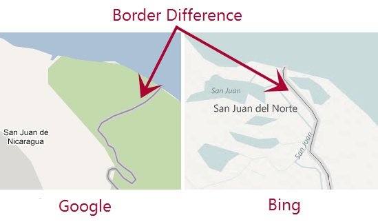
The embarrassing part for Google was that Bing Maps got it right. So if the troops had used a Windows phone or Bing Maps, the invasion may never have happened.