Three years ago, Google devised a satellite imagery technology which virtually removed clouds so that Google Earth and Google Maps users can have a fair and a clear view of the places which do not have high-resolution imagery. And now, this technology has gone through a major makeover resulting in clearer, sharper and seamless imagery.
As Google has added 700 trillion pixels of new data to its service, users will now be able to have better view of forests, fields, seas and cities, thanks to the Landsat 8 satellite.
Landsat 8, which launched into orbit in 2013 by NASA is the newest sensor in the USGS/NASA Landsat Program and is much advanced to its predecessors in many ways. It captures images with greater detail, truer colors, and at an unprecedented frequency—capturing twice as many images as Landsat 7 does every day. This new rendition of Earth uses the most recent data available — mostly from Landsat 8 — making it our freshest global mosaic to date, reports Google Blog.
Here is a look at the better view after the makeover:
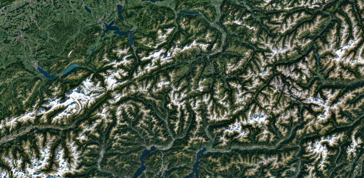
Swiss Alps, Switzerland
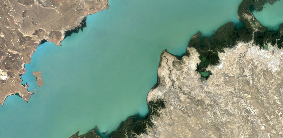
Lake Balkhash, Kazakhstan
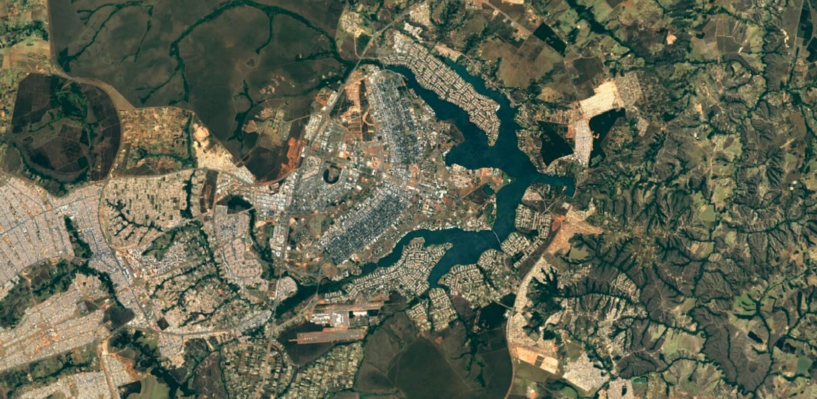
Brasilia, Brazil
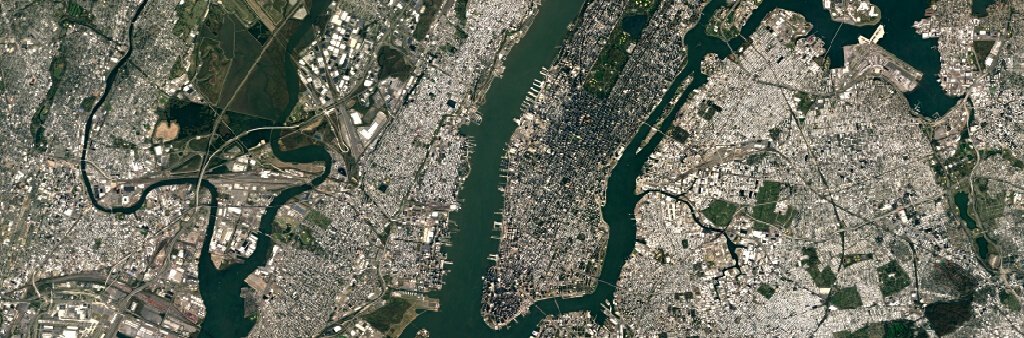
In case you want to see the difference, here is a comparison between the two:
New York City (in 2013)
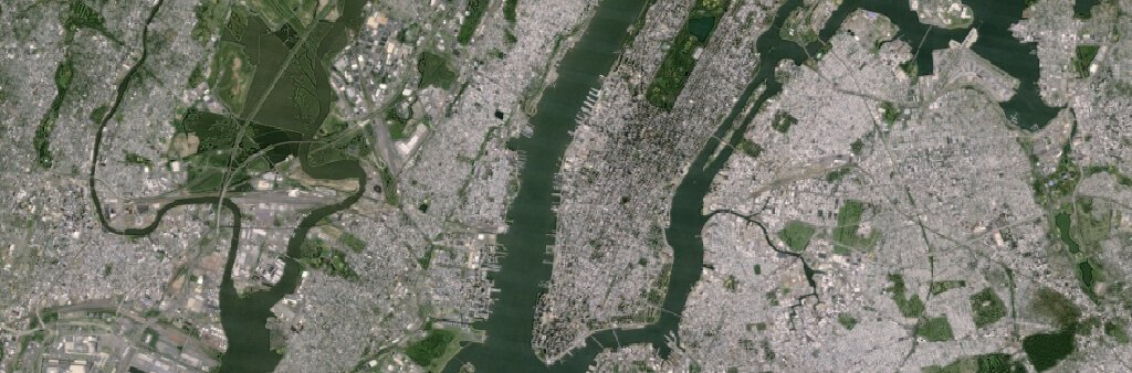
New York City (2016)
(All images sourced from Google Blog)