Global warming and climate change is not a myth, it’s a fact. And, the sooner we take steps to stop it, the better.
If you still think global warming is a sham, check out these pictures, shared by NASA, that show the extent of how climate change is affecting our planet.
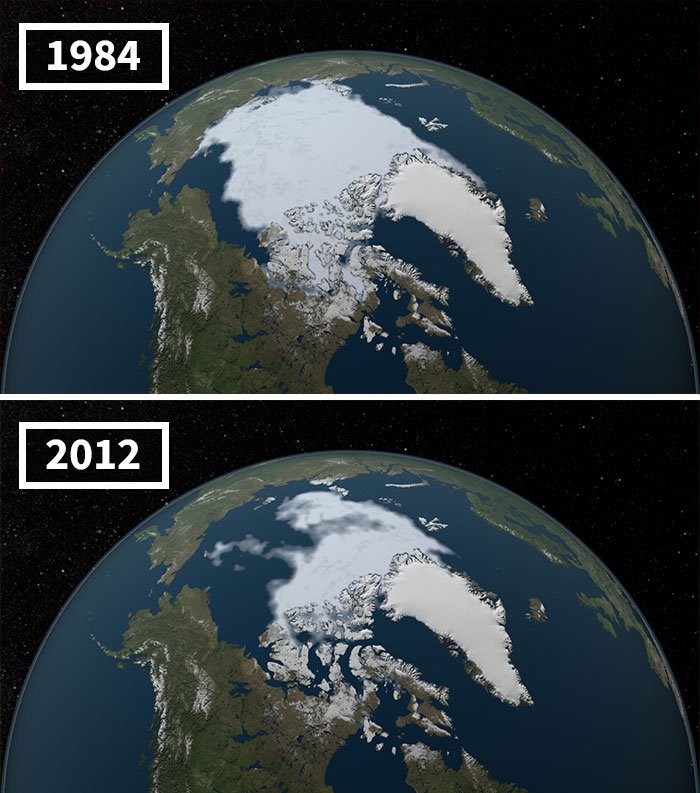
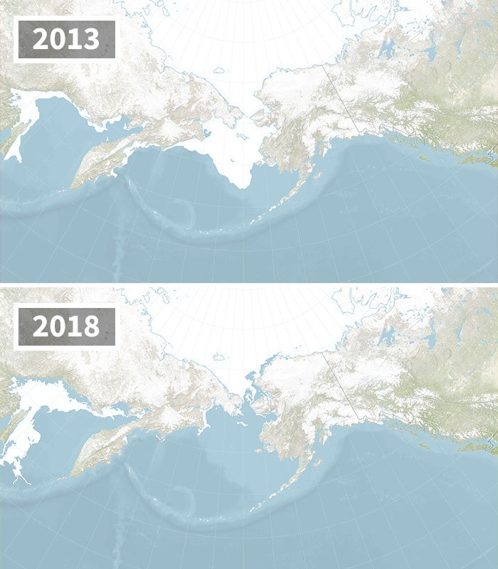
1. The area of the Arctic Ocean that was covered in ice has decreased exponentially overtime.
The image below shows the extent of the depletion from 1984 to 2012 and the ice cover continues to decrease every year. Ever since the late 1970s about 12% sea ice has been lost per decade. Joey Comiso, a NASA scientist says “it’s very likely that the Arctic’s summer sea ice will completely disappear within this century.”
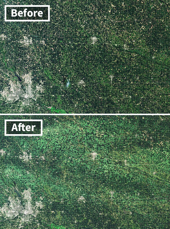
2. A powerful wind storm named Derecho flattens and damages crops in Iowa almost every year.
The hurricane-force winds have a speed of up to 75 mph or more. These images show how much damage the strong winds do on corn and soybean fields in the state of Iowa. The lighter green patches on this before and after image taken in August 2020 indicates the crops that were damaged by the winds.
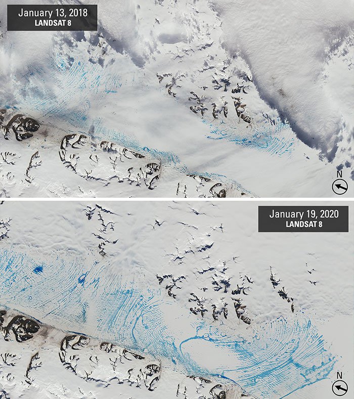
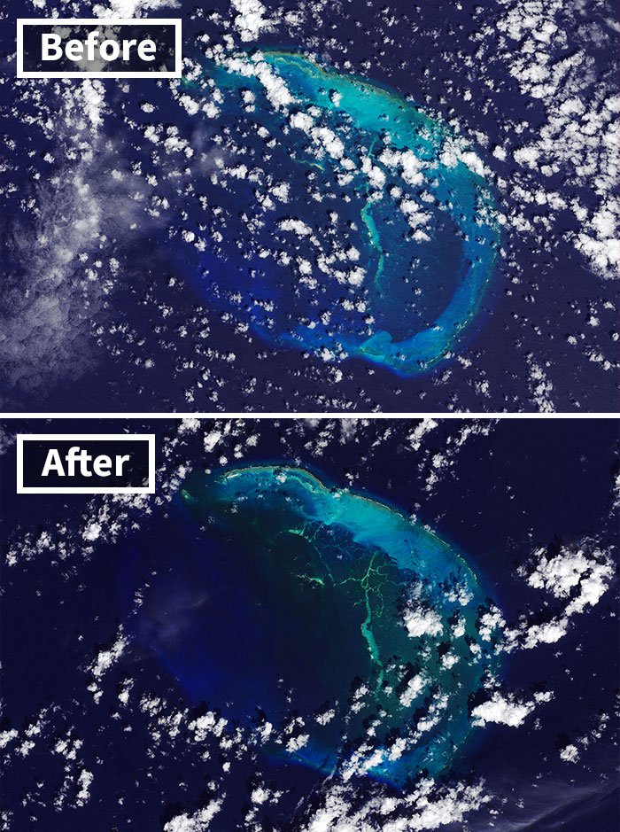
3. Even in Antarctica ice glaciers are melting due to warm summer weather conditions.
The blue area in the 2020 image represents the widespread meltwater pooling that been happening on the George VI Ice Shelf. If you compare the 2020 image with that of 2018, you can clearly see that more water pools of melted ice glaciers have emerged.
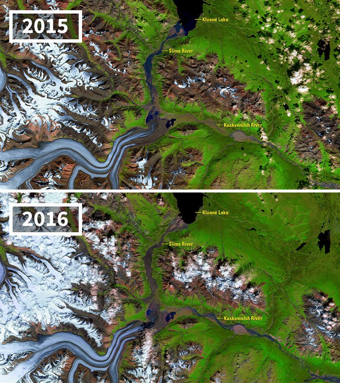
4. The melting of the Kaskawulsh Glacier in Canada has caused changes in the water levels and has possibly altered the downstream ecosystems.
Receding glaciers like this causes a rare instance of river piracy (diversion of one stream’s headwaters into another). Instead of flowing in the north direction into Kluane Lake, most of the river now flows eastward to the Alsek River and Pacific Ocean via the Kaskawulsh River. This brings in sediment changes and changes in the water levels which then directly has an affect on the ecosystem.
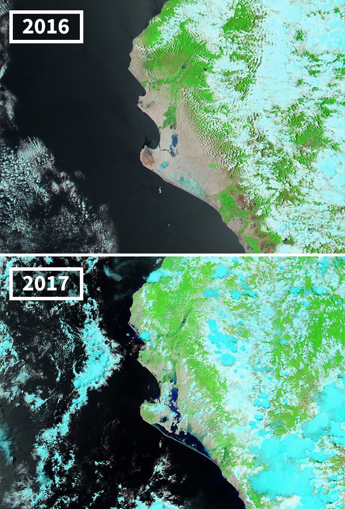
5. Heavy rains have done a lot of damage in Peru and these two images from 2016 and 2017 proves exactly that.
More than 70,000 people lost their homes and more than 60 people lost their lives in mid-March 2017 due to heavy rains in Peru. Both the Lago La Niña and Piura River overflowed their banks, damaging 7,500 kms of roads and 509 bridges. The light blue colour in these pictures indicate the depressions in the ground that took place after salt water evaporated.
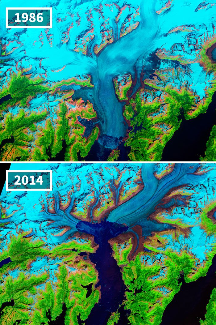
6. Even Alaska’s Columbia Glacier has started melting. Here’s an image comparison of the glacier from 1986 and 2014.
Now, the glacier has thinned out and the up and down motion of the tides affects its flow as much as 12 kilometers (7.5 miles) upstream, until the glacier bed rises above sea level and the ice loses contact with the ocean.
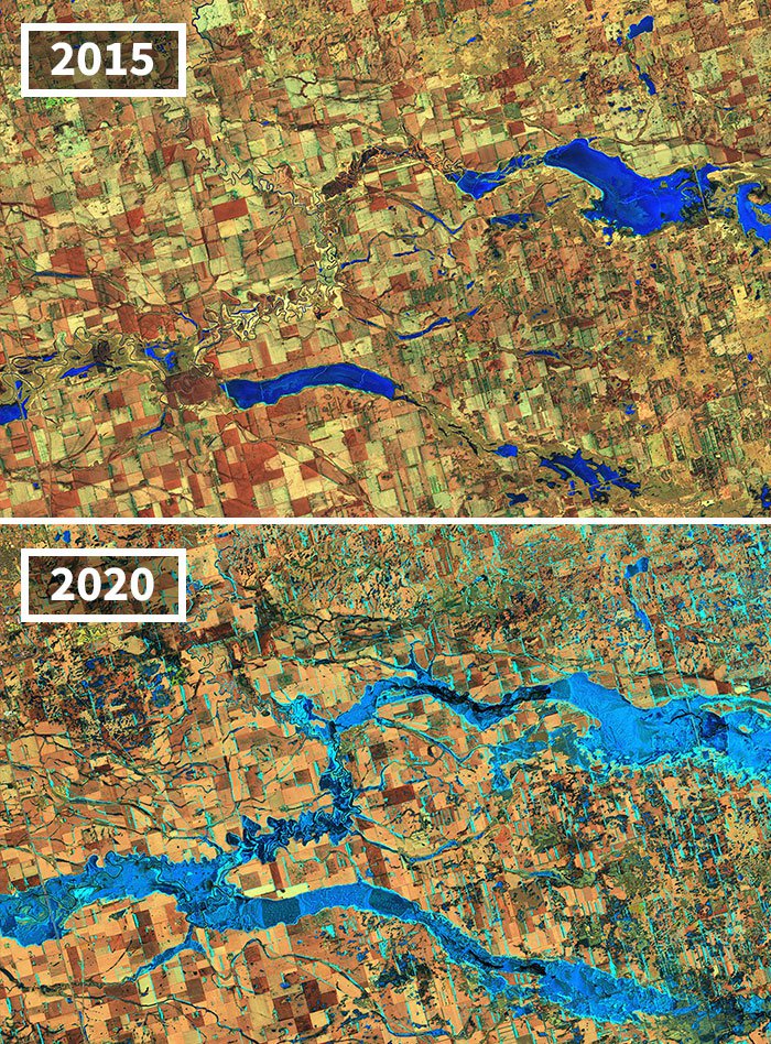
7. These images show a portion of the James River in eastern South Dakota and if you look close enough and compare the two images, you’ll notice that the flood levels have been on the rise.
8. Hawaiian Islands are on the verge of disappearing.
The ‘before’ image taken in September 2018 shows the Northwestern Hawaiian Islands including the East Island. But, after Hurricane Walaka struck in October 2018 almost 11 acres of sand and gravel got washed away and now only two slivers of land are visible in the ‘after’ image.
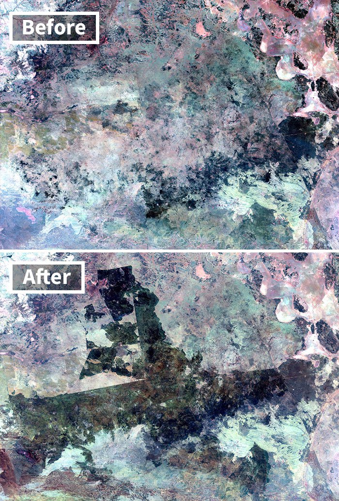
9. Extreme dry conditions have also given rise to major forest fires in north-central Australia over the past few years.
This before and after image shows the extent of the damage forest fires have caused. The dark area in the first image (the damaged vegetation) is far less than the dark area in the second image. This is one of the reasons why the vegetation on the sand ridges and plains is limited largely to short grasses and shrubs.
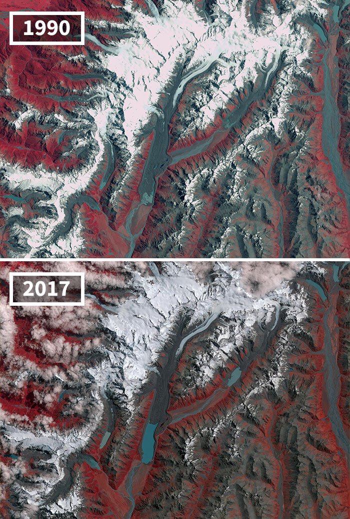
10. Glaciers in New Zealand are also on the verge of shrinking and you can clearly see the difference in these two images given below.
New Zealand is home to almost 3,000 glaciers but, they have been on the decline since 1890 due to global warming. The images shown below include the Mueller Glacier, Hooker Glacier and Tasman Glacier.
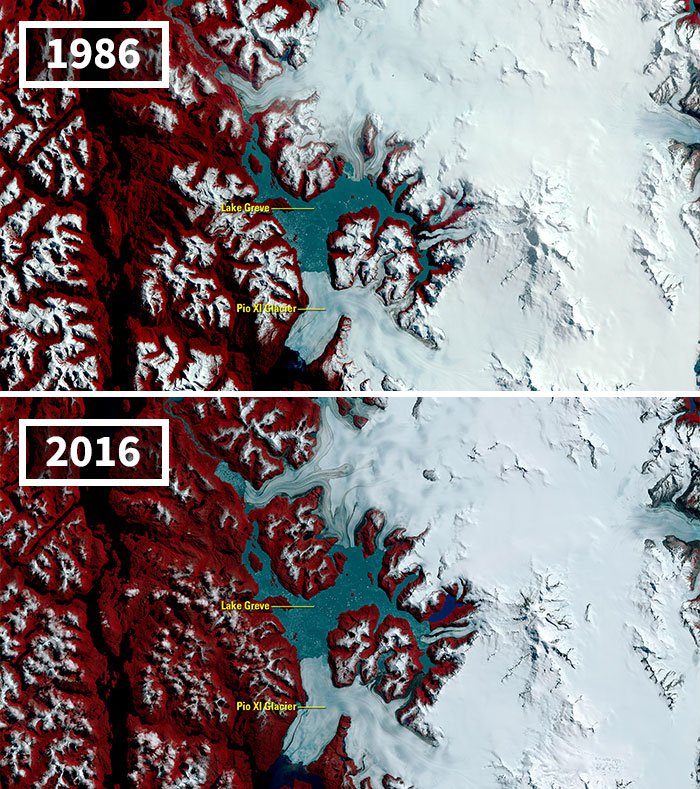
11. Most of the glaciers around the world are declining. This image is from Chile’s Southern Patagonia Icefield.
As per reports, between 1998 and 2014, the glacier’s southern front has advanced 593 meters (about 1,945 feet), and its northern front, which flows into Lake Greve, has advanced 107 meters.
12. Less ice is forming in the Bering Sea since 2017.
Here generally, ice covers more than 193,000 square miles (500,000 square kilometers) of the sea in late April but, that’s not the case anymore. Changes in the ice are also affecting Bering’s ecosystem. You can see the difference between these two images from 2013 and 2018.
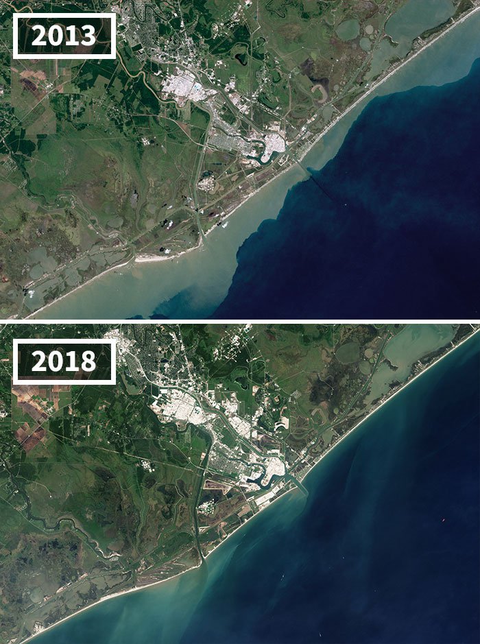
13. Beach erosion has also been on the rise near Freeport in Texas.
In fact, Freeport is one of the largest erosive hotspots in the world. Between 1984 and 2016, 24% of the beaches eroded more than 20 inches per year.
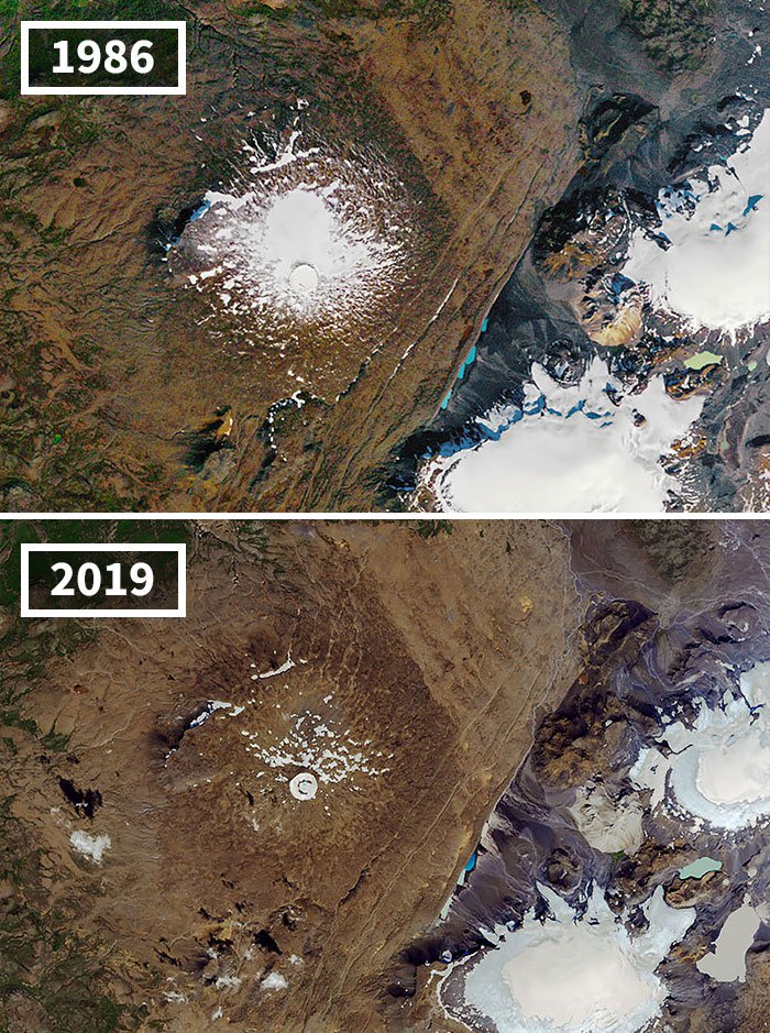
14. Iceland’s OK Glacier is also melting at an alarming rate.
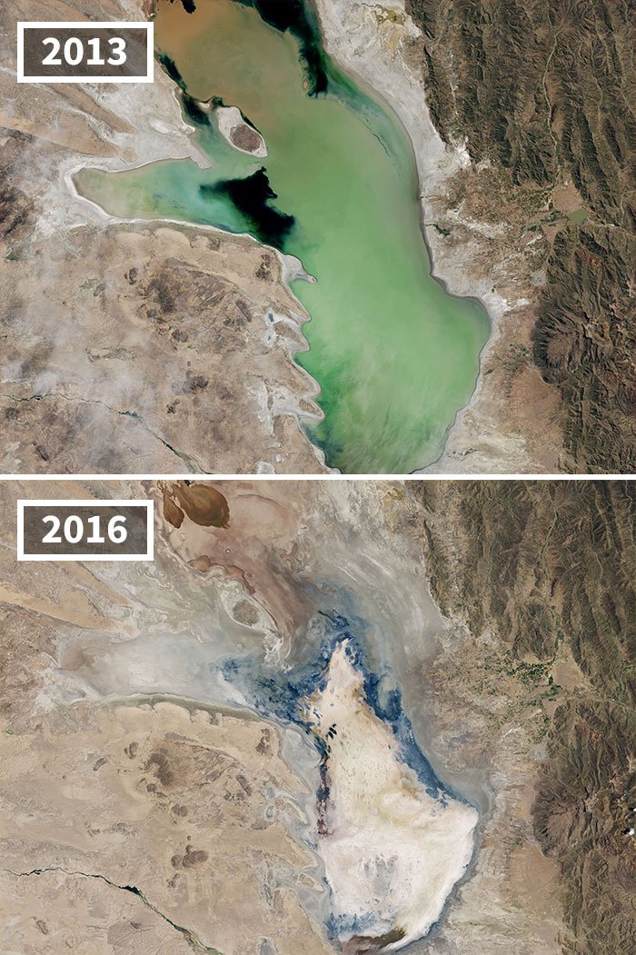
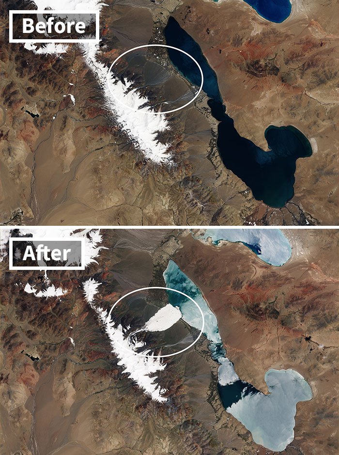
15. Bolivia’s second-largest lake has completely dried up because of drought and diversion of water sources.
Lake Poopó was/is an important fishing resource for local communities but, it no longer exists. The last time it dried was in 1994. It took several years for water to return and even longer for ecosystems to recover.
16. Collapse of a glacier in Tibet’s Aru Range caused an ice avalanche in July 2016.
The avalanche sent a huge stream of ice and rock tumbling down a narrow valley, resulting in many people losing their lives. It was one of the largest ever recorded ice avalanches in history.
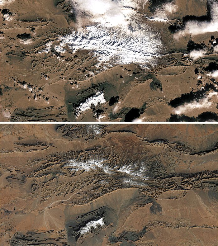
17. This image shows rare snowfalls that take place at the edge of the Sahara Desert in Africa.
Clearly, the amount of snowfall that the Sahara Desert receives now has reduced significantly and you can see the difference in images 1 and 2.
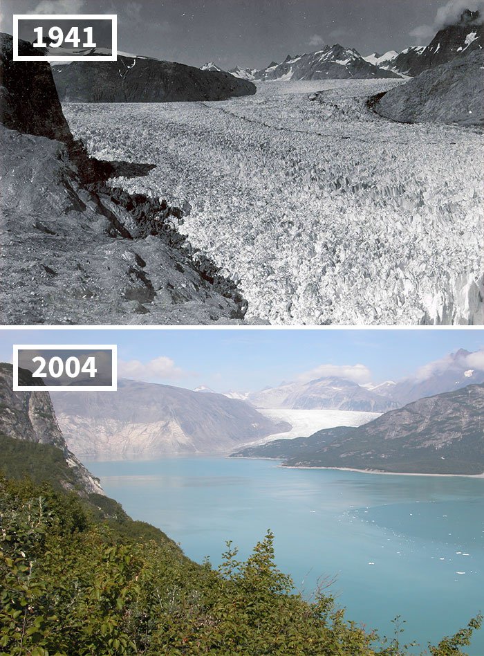
18. The Muir Glacier in Alaska has melted and has thinned out substantially.
Just compare the image taken in 1941 and the one taken in 2004. There’s no way that you can’t spot the difference.
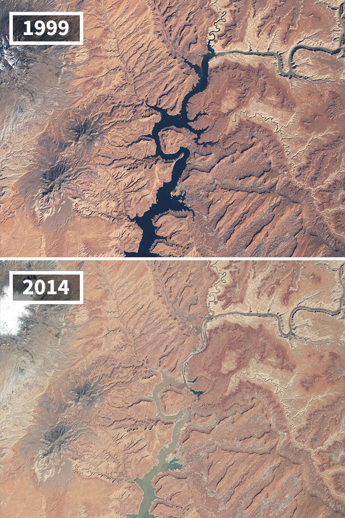
19. Prolonged drought and water withdrawals have dramatically changed Lake Powell’s water level in Arizona and Utah.
The image taken in 1999 shows the water levels near full capacity but, the image taken in2014 shows that the water levels in the lake has dropped to 42%.
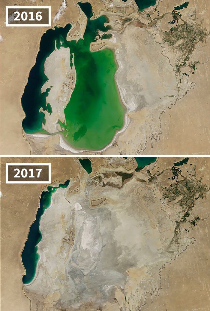
20. Aral Sea in Central Asia has shrunk.
Until the 1960s, Aral Sea was the fourth-largest lake in the world but, by 2014 dry conditions and other facts caused the sea to dry up completely for the first time. In 2016 water levels did rise up but, in 2017 it went down again.
Climate change is real and these pictures are proof.
All images sourced from here.