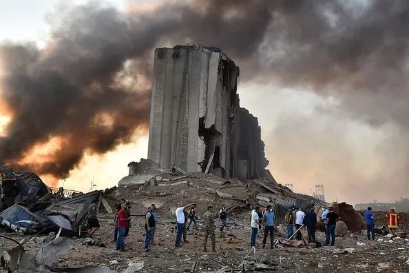
On August 4th, a massive explosion shook the capital city of Lebanon, Beruit. The city was covered in a thick pink smoke cloud.
Footage from the massive explosion in Beirut Port, Lebanon pic.twitter.com/bdvzrS05Qf
— Beirut Today (@bey_today) August 4, 2020
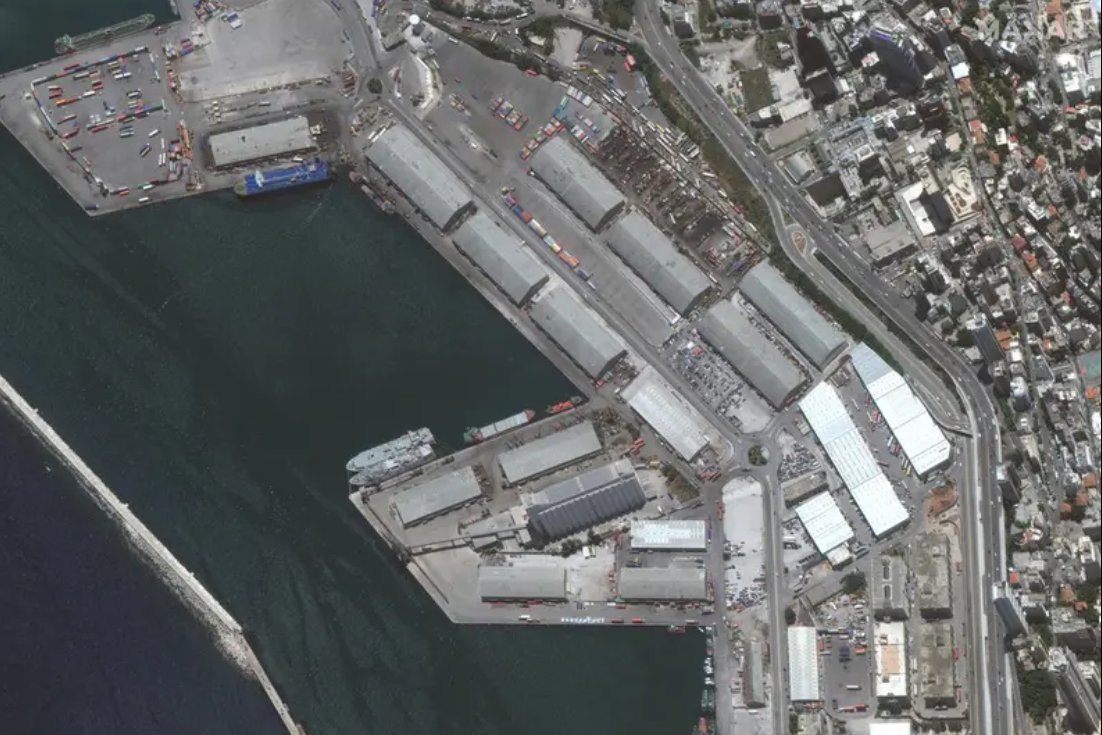
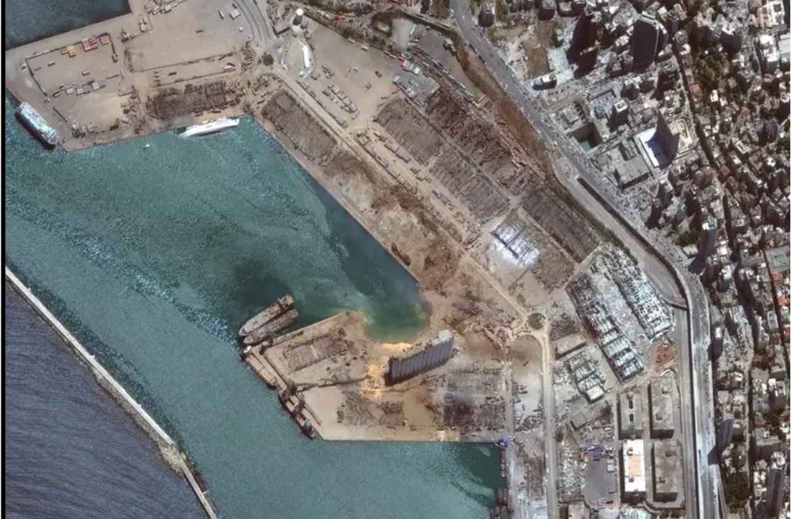
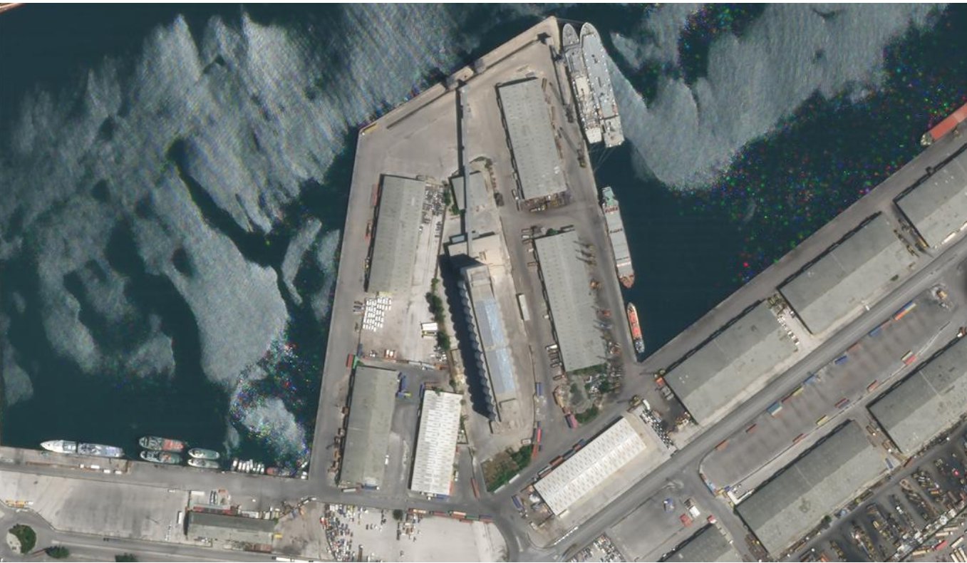
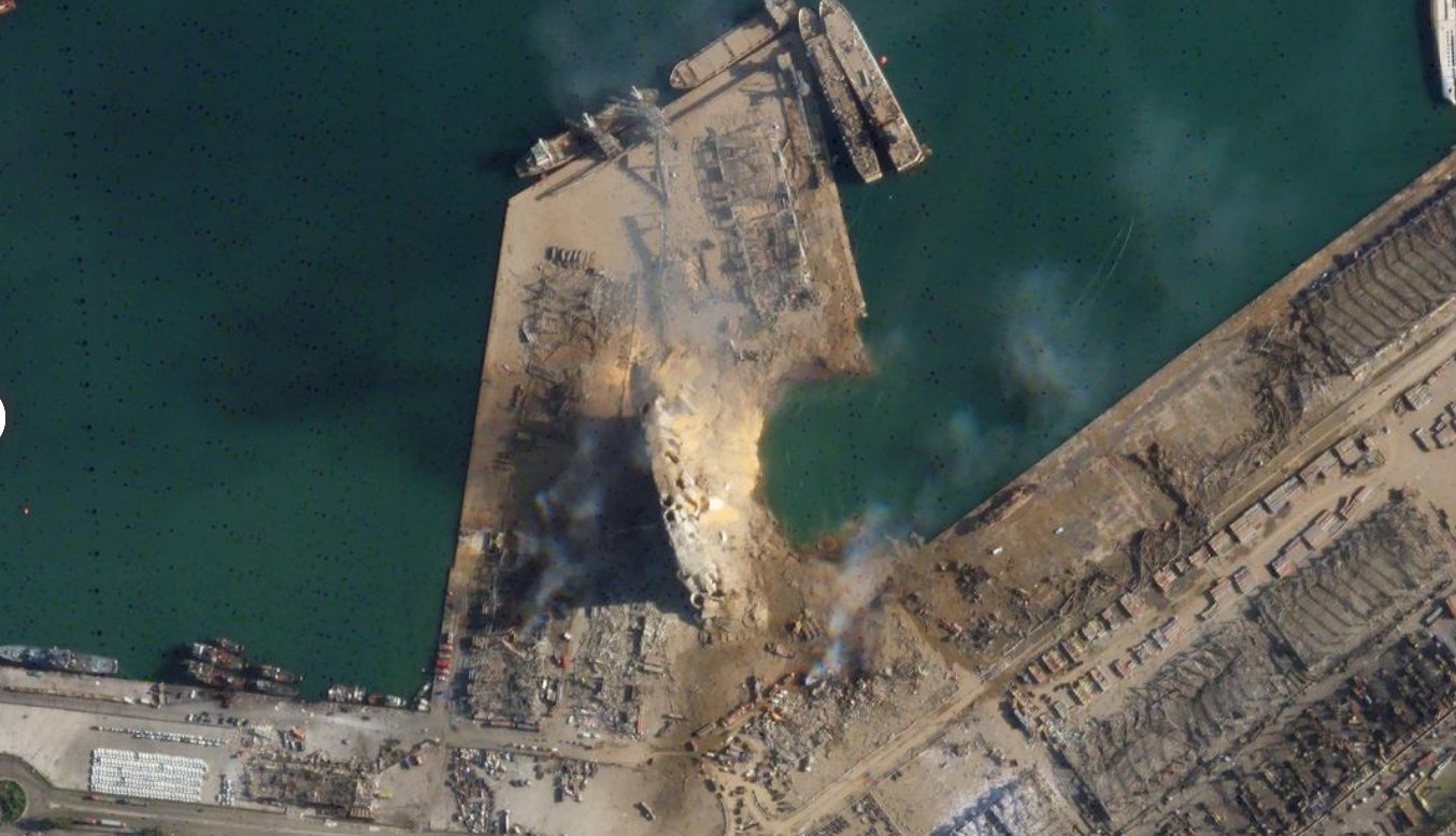
Satellite images, showing the comparative before and after state of Beirut give us an insight into the intensity of the catastrophic explosion.
BEFORE
AFTER
BEFORE
AFTER
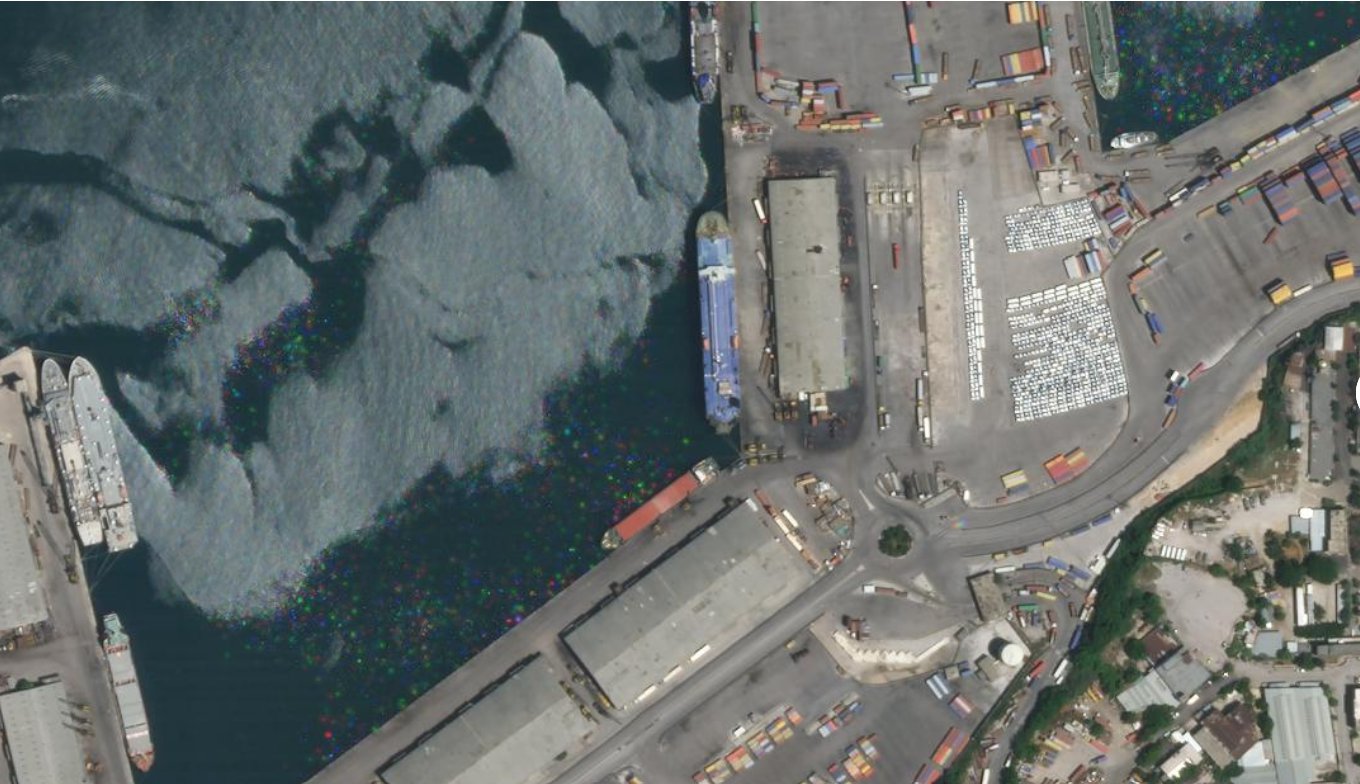
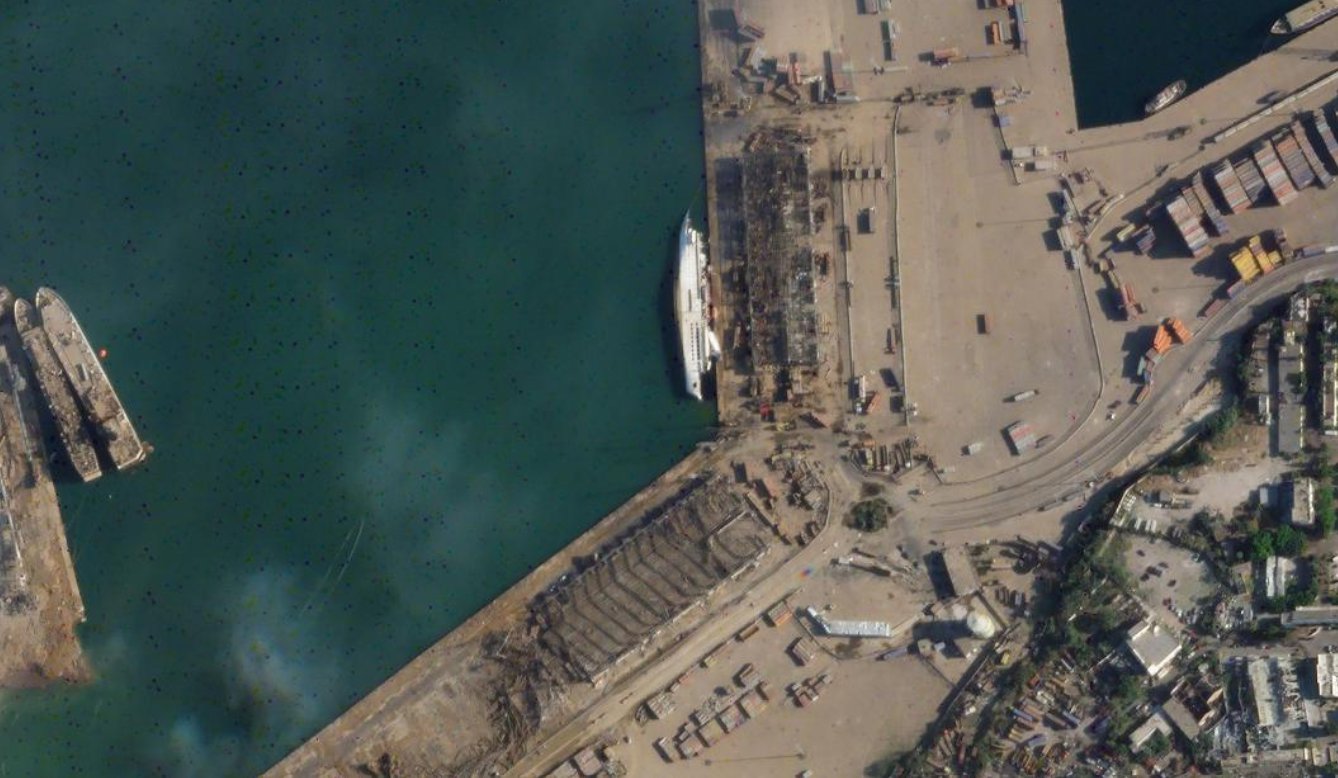
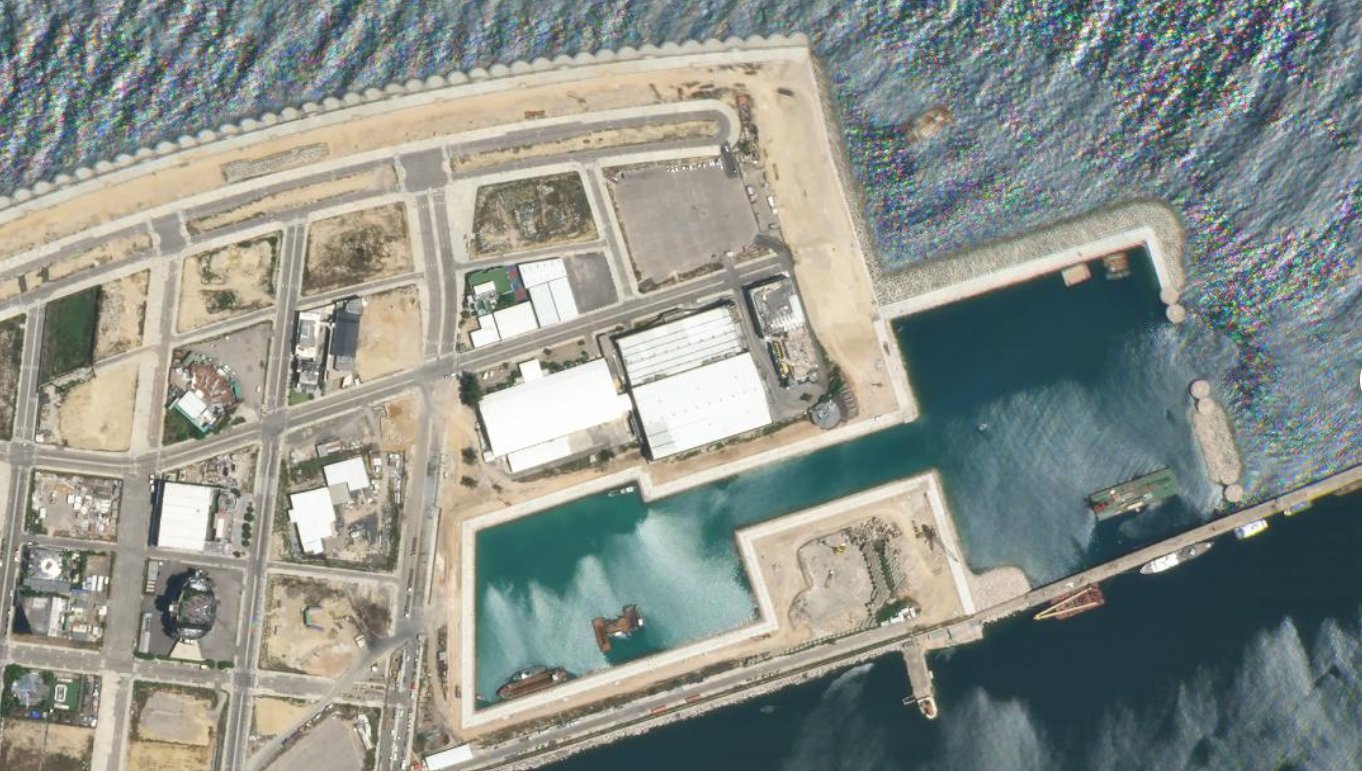
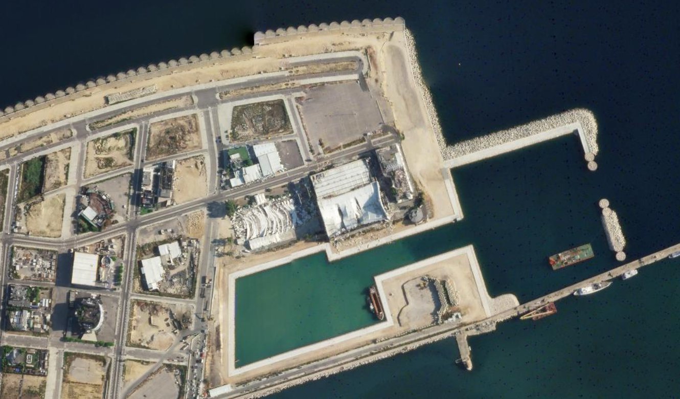
Waves of damage from the explosion reached a peninsula in the eastern direction of the blast sight. In the following images, you can see a boat toppled onto its side.
BEFORE
AFTER
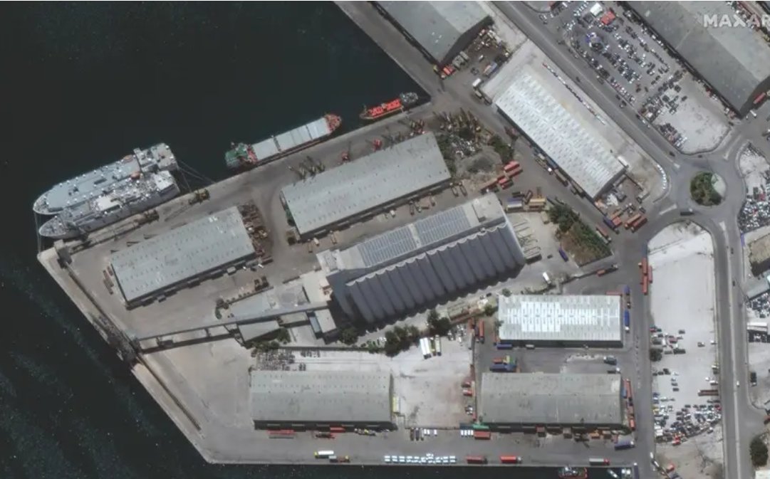
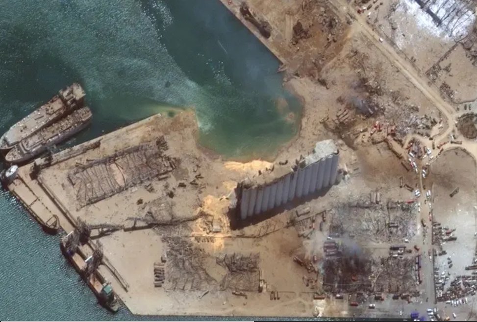
A close-up of the grain silo at the Beruit port on June 9 and then on August 5:
BEFORE
AFTER
Images from an adjoining neighborhood to the east of the side shows the devasting damage, primarily to the roofs:
BEFORE
AFTER
According to various reports, the force of the explosion as measured by scientists at the University Of Sheffield was one-tenth of the power of the atomic bomb dropped on Hiroshima during the World War.
#Breaking: Massive Explosion near Beirut’s Port. #Lebanon pic.twitter.com/Hua7igJZxK
— Timour Azhari (@timourazhari) August 4, 2020
As we write this, the death toll of this catastrophic explosion has risen to 135 and left around 5,000 people injured. However, as many people still remain missing, reports suggest that the death toll could rise further.